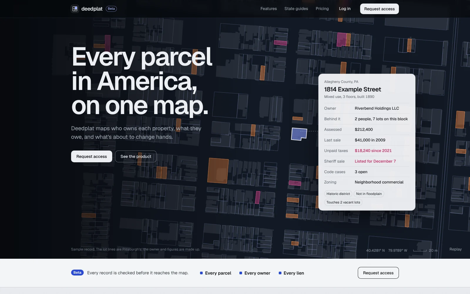
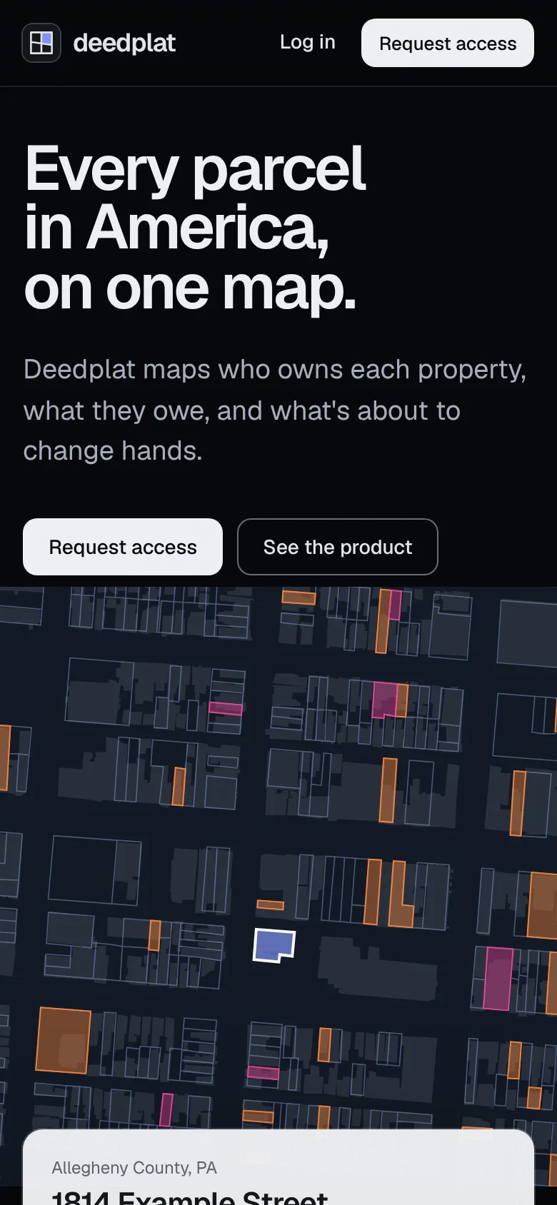
Who owns each property, what they owe, and what’s about to change hands.
Allegheny County, PA
1814 Example Street
OwnerRiverbend Holdings LLC
Unpaid taxes$18,240 since 2021
Sheriff saleListed for December 7
The challenge
Property data is public but scattered across thousands of county offices, each with its own system. The site had to show the whole country and the detail of one lot on the first visit.
The idea
Show one lot, completely. A globe spins down to a single Pittsburgh parcel and opens its record, so you see the whole country and the one answer you came for in the same ten seconds.
Where it landed
Live at deedplat.com: the globe, a 15-second demo of the real app, a features page, pricing by county, and guides to property records in every state.
CLIENT
Deedplat
OUR ROLE
Mark, website, writing, state and county guides, share images, product design
AUDIENCE
Investors, brokers, developers, lenders and land banks
STACK
Hand-built HTML, CSS and JavaScript, Geist, Supabase, Cloudflare
01The context
Deedplat maps every parcel in a county: who owns it, who’s behind the LLC, what’s owed, and what’s coming up at sheriff sale. It launched with a new name, a new mark and a public site, built out from Pittsburgh.
The app lives at app.deedplat.com and is in beta. This case file is mostly about everything in front of it.
02The problem
Data products tend to sell with a dashboard screenshot and a list of features. Nobody can tell from that whether their county is covered, or whether the data is any good.
Deedplat needed to feel national and precise at once: big enough to cover where you work, careful enough to trust with a deal.
03The mark
A plat is the drawing of how land is divided into lots. The mark is one: a square split by a lot line that isn’t quite straight, with one parcel filled in blue. It works at 16 pixels in a browser tab and as an app icon.
96px48px24px16px
04The system
Clean, light software, with a few surveyor’s details: a faint survey grid behind page heads, north arrows on the maps, a coordinate readout on the globe and the South Side’s lot lines drawn into the footer. One typeface, Geist, carries everything. Blue is saved for the parcel you’re looking at.
Paper #EEF0F3 Most of every page, under the grid.
Ink #14171B Type, buttons and the closing panels.
Plat blue #2B4BDB The selected parcel and links.
Sheet #FAFBFC Cards and records.
05Built to be found
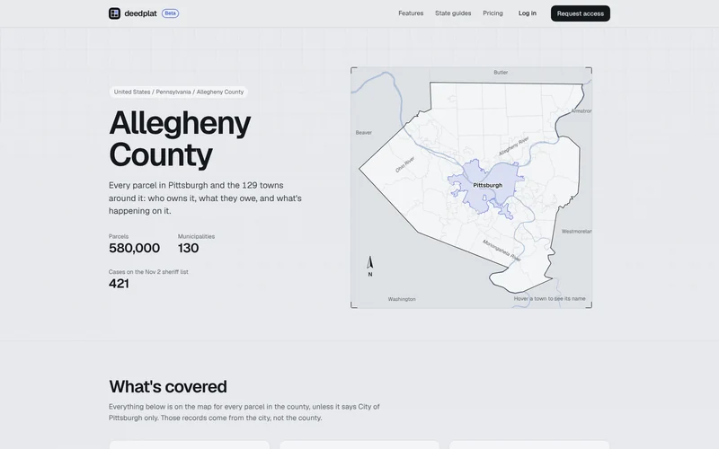
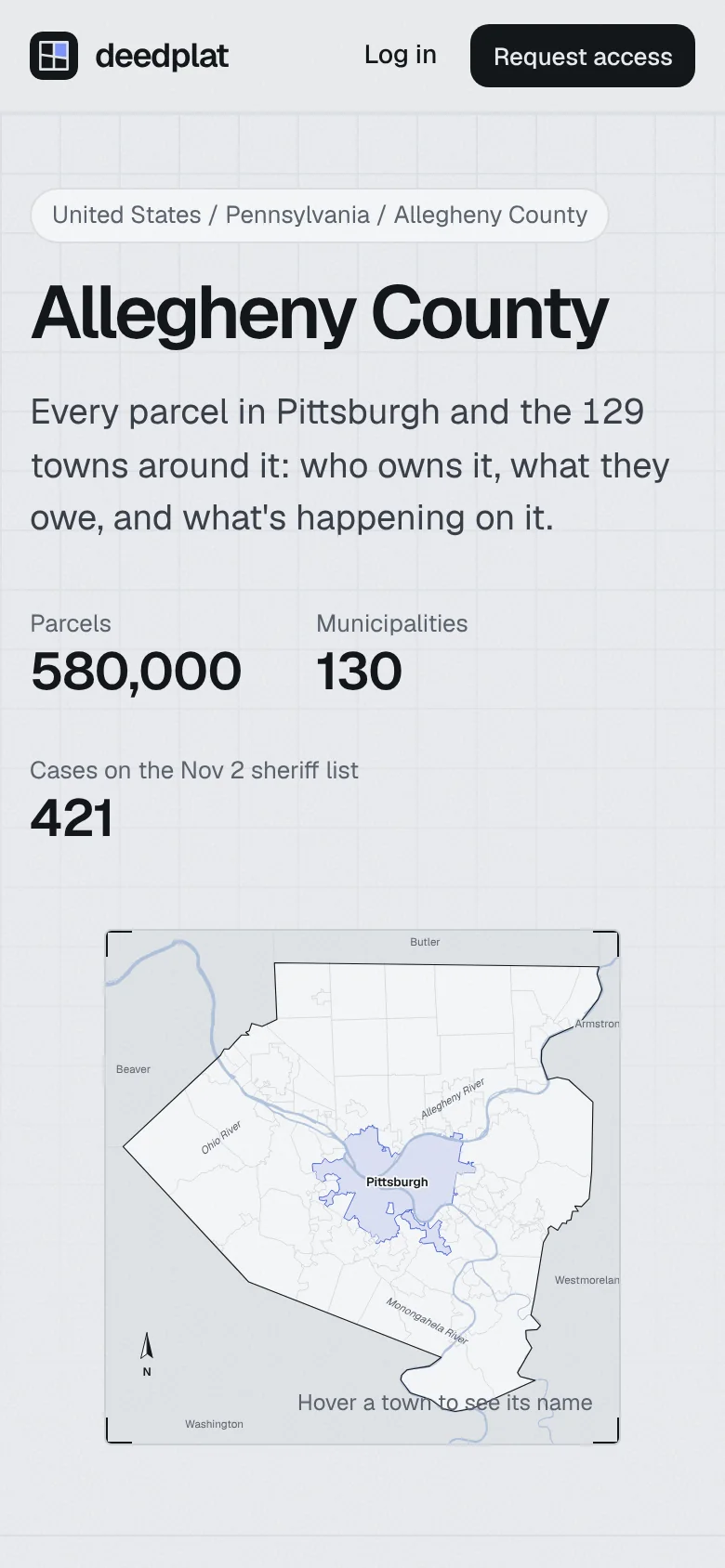
People search for property records by place: “Allegheny County property records,” “Florida sheriff sales.” So Deedplat has a guide for every state and DC, down to the county. Each one says what’s public there, what’s hard to get, and how distressed property changes hands, with a county map, sources and answers to common questions.
50 + DCstates with a guide
Everypage with its own share image
15 sdemo of the real app
06Key decisions
01
One lot, not a dashboard
The hero zooms from the whole globe to one parcel and opens its record. You see the scale and the detail in one move.
Chose: the globe dive · Passed: a dashboard screenshot
02
The real product, moving
The sample product screen was replaced with a 15-second recording of the actual app, so what you see is what you get.
Chose: a real demo · Passed: a mockup
03
Priced by county
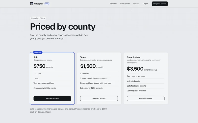
Customers think in counties, so that’s what they buy. Every plan says how many counties and seats it includes, on one page.
Chose: per county · Passed: “contact sales”
04
A guide for every state
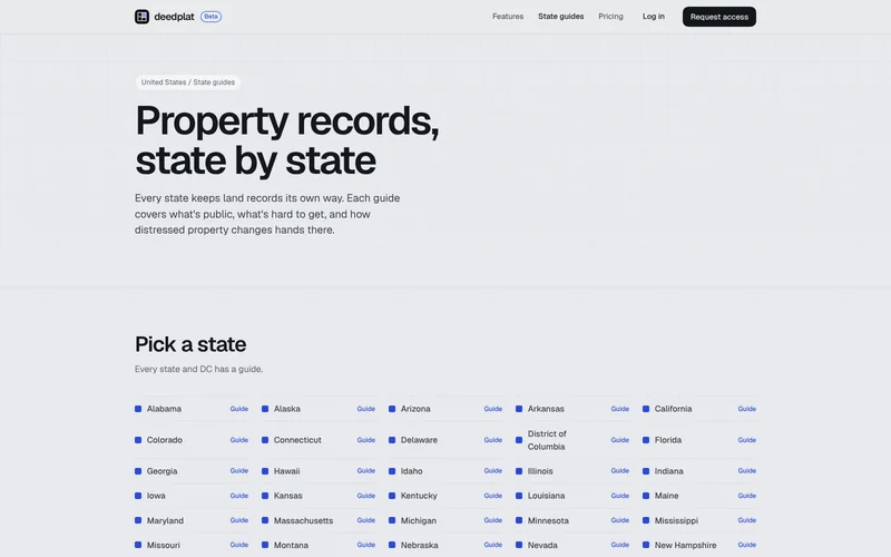
Each state keeps land records its own way. Writing that down for all 50 states and DC answers the first question a buyer has, and brings them in from search.
Chose: a guide per place · Passed: a coverage list
07The site, up close
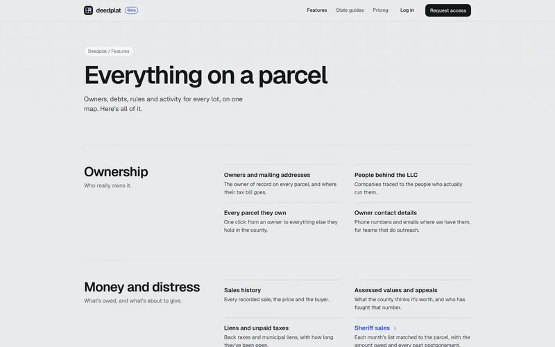
Features: everything on a parcel, grouped by what you’re asking.Pricing: three plans, all by county.State guides: every state and DC.A county guide, with the county’s map and its towns.
The homepage, on a phoneA county guide
08Timeline
Deedplat gets its name and mark. The public site goes up: a national county map, the globe that dives to one Pittsburgh lot, a Pennsylvania page and a request-access form.
Features, pricing and request-access pages, a design polish with the surveyor’s details, the real app demo, and property-records guides for every state and their counties, each with a share image.
Final pricing, and a 404 with Monty surveying an empty parcel.
More counties opening in the app, and the guides that go with them.
09What Swamp Kitten did
Identity: the plat mark and the light, surveyor’s system around it
Website: strategy, design and build, from the globe dive to the closing panels
Writing: every page, plus the state and county guides with sources and FAQs
Product: the app’s clean, search-first design, and the demo that shows it
Details: request access saved to Supabase, share images for every page, sitemap, clean URLs with redirects, a Monty 404 and hosting on Cloudflare
 deedplat Beta